
Note: The content of this post is from answers to questions posed on Quora, written by Dylan Duverge. For the originally published content, Click Here.
Site-Specific Testing
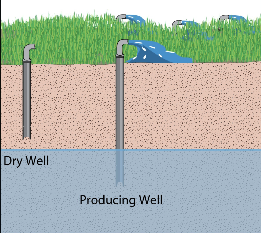
One very common procedure to determine the “refill” rate is to do a well test. One type of test is a constant rate test, whereby you continuously measure declines in the water level as you pump the well at a known and constant rate. In a productive aquifer, the rate of decline will decrease until there is little to any change in the water level, despite continued pumping. The water level before you started pumping is called the “static” water level, and the water level while pumping, once stabilized, is called the “pumping” water level. This and a few other steps is how you determine the well’s sustainable yield (e.g., in gallons per minute). Another method I won’t go into is a “step” test but the idea is the same. The distance between the static and pumping water levels varies based on geology, and so does the rate at which it refills once you turn off the pump (recovery curve). If your water level is decreasing past the depth of the pump, or below the screened interval of the well, either your pump is set too high within the well casing, you are pumping at a higher rate than the aquifer can support, or one or more of your neighbors is affecting the static and pumping water levels. Larger factors such as drought and decreased watershed recharge can also affect this.
“Desktop” Methods
To come up with a reasonable estimate of a well’s yield, several resources can be consulted which individually, or in combination, could help answer whether wells in any one particular area have good yield (and thus faster “refill” rates):
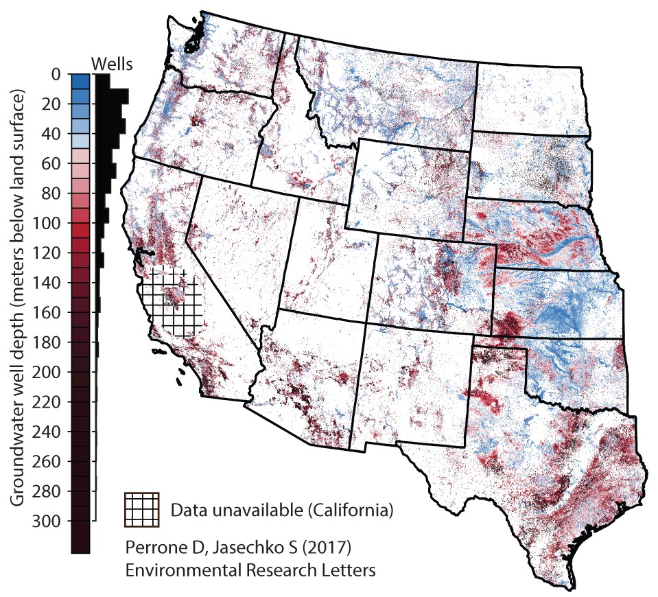
- Records of wells drilled by others: In the United States, most if not all areas require that as part of obtaining a well permit, a well driller must submit a record of the well’s construction, and if applicable, the results of any well tests like those described above. This is usually held by the City, County, or State and is usually public record, so a google search for “well completions reports”, “well permits” or “well logs” plus the specific location will usually point one in the right direction. I know, for example, that California has a really good web map portal available online where well completion reports can be downloaded in PDF format. These documents provide local evidence of the predominant geology and stratigraphy, as well as prevailing water levels and well yields when collected together.
- Published hydrogeological investigations: Regional or local reports on the area’s geology will sometimes identify the region’s major aquifers and will have have estimates of their hydrogeological properties. While these can sometimes take some real research to find (e.g., local libraries, universities, county/municipal water agencies, etc.), a lot of the most important one are often available online. For example, the USGS National Geologic Map Database can often have reports on a region’s groundwater, including prevailing yields for different geological formations. Best way to find local results is to use the “mapview” link, zoom to the appropriate area, and type in “water” or “groundwater” in the keyword search field. Sometimes there won’t be anything available but it’s always worth checking.
- Calling local experts: A conversation with a local well driller, geologist, or the local utilities/water department can often be the most helpful. Well drilling companies, because they’ve been in the field for years or decades seeing in person how wells they drill perform, will know which areas have water problems and which areas have good wells. Sometimes getting a knowledgeable person on the phone can save you hours of research and internet sleuthing. (By the way, this is a really important step to take prior to purchasing a house or land without municipal water connection, and is not included in typical due diligence reports).
There are several other desktop methods of finding where well would be good, such as aerial photograph review, geological research, and review of local hydrology and biology, but it requires a lot of interpretation by someone who has studied geology or a similar field. It’s usually best to find a local consultant who can spend some time doing all this and summarizing the results in a report, if possible.